Vici.org
Il n'y a pas d'images. Télécharger une image.

Les environs:

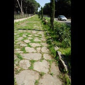
Via Selciatella

Localisation:

  • Italie, Le Ferriere
  • geo:41.512505,12.755124
  • Précision ± 5-25 m.

Classification:

  • Ville
  • Visible

Identificateurs:

Annotations

Il n'y a pas une annotation en français. Présenté est une annotation en Anglais.

See http://en.wikipedia.org/wiki/Satricum

  1. Marijke Gnade, Mauro Rubini: Satricum in the post-Archaic Period. A Case Study of the Interpretation of Archaeological Remains as Indicators of Ethno-Cultural Identity, Satricum Series. Reports and Studies of the Satricum Project, 6, Peeters 2002
  2. Marijke Gnade: Satricum. Trenta anni di scavi olandesi, Università di AmsterdamAmsterdams 2008
À proximité

Satricum, Mater Matuta Temple

Santuario di Mater Matuta

Satricum, Southwest Necropolis

The southwest necropolis of Satricum.

Via Selciatella (7 km)

Roman Rd