
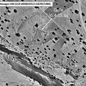
GAUBE Heinz (1973), Die sudpersische Provinz Arragan - Kuh-Giluyeh von der arabischen Eroberung bis zur Safawidenzeit

Location:
- Iran (Islamic Republic of), Deh Kohneh
- geo:30.967396,51.260124
- Location ± 0-5 m.
Period or year:
- 2xx~ / 6xx~
Class:
- Bridge
- visible
Identifiers:
- vici:place=104713
Annotations
Nearby
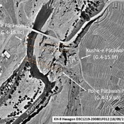
Pol-e Pātāwah III (G.4-15.IIc)
Late Islamic ruined bridge over the Khersaan. Surveyed by Gaube (1968), who described several remaining piers and arches. Part of a series of at least 5 historical bridges over the Khersaan, made necessary by the changing course of the river.
Kushk-e Pātāwah (G.4-15.IIf)
Early and middle Islamic squared large structure, a possible caravanserai. Rebuilt in early modern times as a fortified manor (kushk). Surveyed by Gaube (1968). Clearly visible on KH9-Hexagon imagery (1984). Since destroyed.
Pol-e Pātāwah IV (G.4-15.IId)
Early medieval Islamic ruined bridge over the Khersaan. Surveyed by Gaube (1968), who describes five remaining stone piers on the eastern bank, since destroyed by modern works. Partially visible on KH9-Hexagon imagery (1984).