Vici.org
Il n'y a pas d'images. Télécharger une image.

Les environs:

Hubertuskapelle - Römische Spolie

Localisation:

  • Allemagne, Jünkerath
  • geo:50.339535,6.588618
  • Précision exacte

Classification:

  • Camp fortifié
  • Invisible

Identificateurs:

  • vici:place=10431

Annotations

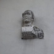
Spätantike (310-320?) Runde Kastell, Durchmesser von 130 m. mit 13 Türmen.


siehe: http://www.jahrbuch-daun.de/VT/hjb1985/hjb1985.110.htm

und

http://www.pointoo.de/poi/Juenkerath/Ehemalige-roemische-Strassenstation-276868.html


À proximité

Gallo-römisches Gräberfeld - Jünkerath

Gallo-römisches Gräberfeld - Jünkerath -point imported from roscheiderhof.de

Icorigium (1 km)

OmnesViae import TPPlace894

Römerstraße Köln-Trier (Abschnitt Jünkerath) (1 km)

Römerstraße Köln-Trier (Abschnitt Jünkerath)