Er zijn nog geen Nederlandstalige annotaties. Hier volgen annotaties in het Engels.
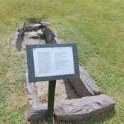
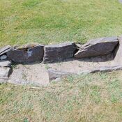
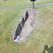
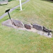
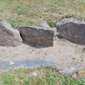
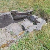
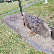
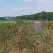
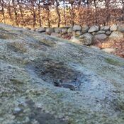
Bregninge Præstegård (Site 090502-58) in Svendborg Municipality features archaeological evidence primarily related to a settlement (Bosættelse) dating to the Bronze Age (1100 – 500 BC). A museum excavation conducted in 1983 uncovered a small portion of this hilltop settlement, revealing several pits and post holes. Finds included pottery from the Late Bronze Age, Period V, although the total extent of structures belonging to this specific period remains undetermined. The Bronze Age settlement layer was found to be overlaid by later activities, including a slag pit. It is presumed that the main area of the ancient habitation is located within the current rectory garden, west of the excavated area.
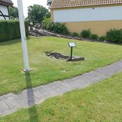
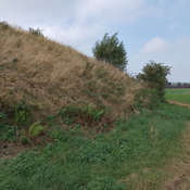
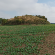
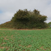
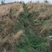
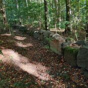
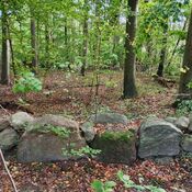
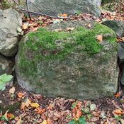
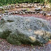
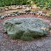
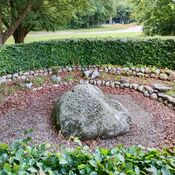
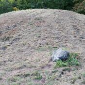
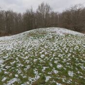
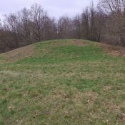
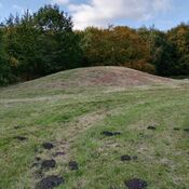
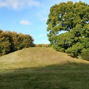
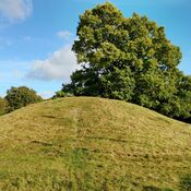
The location is also distinguished by a large Round Barrow (Gravhøj) situated within the private garden of the Bregninge Church Rectory. This monumental mound measures about 4 meters high and 28 meters in diameter. While confirmed as a burial mound in 1877, its most notable feature is a path known as a Sneglegang (spiral path) that leads from the foot to the flat summit. This spiral ramp is generally interpreted not as an ancient feature, but as a landscaped path, likely constructed during the 17th or 18th century to access a summer house (lysthus) that maps suggest once stood atop the barrow. Historical records indicate the mound’s fill includes kitchen midden layers, thick charcoal, and seashell remnants. The barrow remains a protected ancient monument.
https://www.youtube.com/watch?v=hfxAbRELXfA
https://www.kulturarv.dk/fundogfortidsminder/Lokalitet/113566/
Bregninge Præstegård (Site 090502-58) in Svendborg Municipality features archaeological evidence primarily related to a settlement (Bosættelse) dating to the Bronze Age (1100 – 500 BC). A museum excavation conducted in 1983 uncovered a small portion of this hilltop settlement, revealing several pits and post holes. Finds included pottery from the Late Bronze Age, Period V, although the total extent of structures belonging to this specific period remains undetermined. The Bronze Age settlement layer was found to be overlaid by later activities, including a slag pit. It is presumed that the main area of the ancient habitation is located within the current rectory garden, west of the excavated area.
The location is also distinguished by a large Round Barrow (Gravhøj) situated within the private garden of the Bregninge Church Rectory. This monumental mound measures about 4 meters high and 28 meters in diameter. While confirmed as a burial mound in 1877, its most notable feature is a path known as a Sneglegang (spiral path) that leads from the foot to the flat summit. This spiral ramp is generally interpreted not as an ancient feature, but as a landscaped path, likely constructed during the 17th or 18th century to access a summer house (lysthus) that maps suggest once stood atop the barrow. Historical records indicate the mound’s fill includes kitchen midden layers, thick charcoal, and seashell remnants. The barrow remains a protected ancient monument.
https://www.youtube.com/watch?v=hfxAbRELXfA
https://www.kulturarv.dk/fundogfortidsminder/Lokalitet/113566/


")