Er zijn nog geen Nederlandstalige annotaties. Hier volgen annotaties in het Engels.
The area at Gammel Hestehave in Svendborg has a long history of settlement, dating back 5000 years to the first coastal settlements. Later, in the late Younger Stone Age (1900-1700 BC) and the Elder Bronze Age (1700-1100 BC), settlements moved inland. The Elder Bronze Age is particularly significant, with a grave field of 23 larger and smaller burial mounds established during this period. These mounds were part of a community and were highly visible from surrounding areas like Thurø, Tåsinge, and Svendborgsund, standing out monumentally in what was then open land.
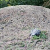
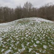
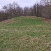
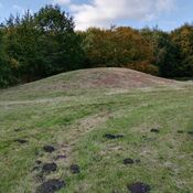
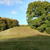
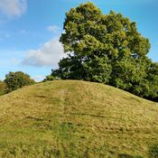
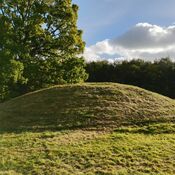
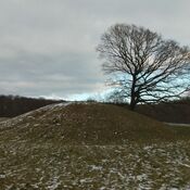
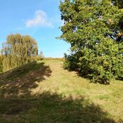
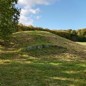
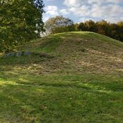
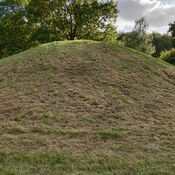
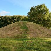
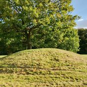
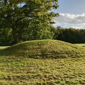
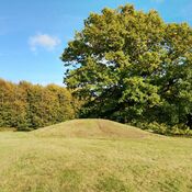
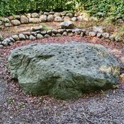
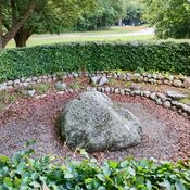
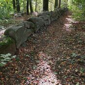
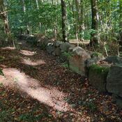
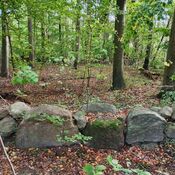
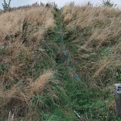
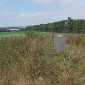
The specific mound mentioned here is a round barrow dating to prehistory times. It is a national landmark located in Svendborg. The mound is situated besides a house, and is visible from a municipal road, Hallindskovvej. Its dimensions were recorded differently over time, initially 3.8 x 26 m and later as a monumental large mound, 3.4 x 21.5 x 14.0 m. It is currently heavily overgrown. A large tree stands on the side of the mound.
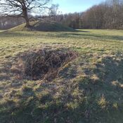
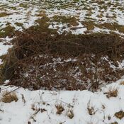
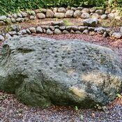
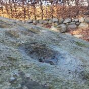
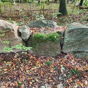
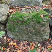
The base of the mound has been partly dug away, standing as a roughly 50 cm scarp towards the east or about a 0.6 m high stone setting in the north, east, and south. Several old buildings are located close to the mound's base. A larger stone stands at one corner towards the road. A concrete pipe is noted on the top. The surface, especially near the top, has been significantly damaged by "rabbit-hole-like" digging, likely from children seeking treasure, as indicated by a child-sized shovel and spade found nearby. A fragment of a Roman-era urn was also collected from a soil pile at the digging site.
The site has undergone various historical activities and surveys, including grave activity in 1947, museum surveys in 1947 and 1983, and periodic monitoring in 2009 and 2019. It was registered in 1947 and re-surveyed in 1983 when its condition was detailed. It was designated a monument of national importance in 2010 and new signage was installed. It is a protected site, having been granted protected status in 1937 or later. Arkæologi Sydfyn is the responsible museum.
The house, which is located next to the burial mound, is notable for a bicycle path that goes through the house, which is then built across the bicycle path.
https://www.youtube.com/watch?v=-oRFXJyCUiM
Source:
https://www.kulturarv.dk/fundogfortidsminder/Lokalitet/9118/
The area at Gammel Hestehave in Svendborg has a long history of settlement, dating back 5000 years to the first coastal settlements. Later, in the late Younger Stone Age (1900-1700 BC) and the Elder Bronze Age (1700-1100 BC), settlements moved inland. The Elder Bronze Age is particularly significant, with a grave field of 23 larger and smaller burial mounds established during this period. These mounds were part of a community and were highly visible from surrounding areas like Thurø, Tåsinge, and Svendborgsund, standing out monumentally in what was then open land.
The specific mound mentioned here is a round barrow dating to prehistory times. It is a national landmark located in Svendborg. The mound is situated besides a house, and is visible from a municipal road, Hallindskovvej. Its dimensions were recorded differently over time, initially 3.8 x 26 m and later as a monumental large mound, 3.4 x 21.5 x 14.0 m. It is currently heavily overgrown. A large tree stands on the side of the mound.
The base of the mound has been partly dug away, standing as a roughly 50 cm scarp towards the east or about a 0.6 m high stone setting in the north, east, and south. Several old buildings are located close to the mound's base. A larger stone stands at one corner towards the road. A concrete pipe is noted on the top. The surface, especially near the top, has been significantly damaged by "rabbit-hole-like" digging, likely from children seeking treasure, as indicated by a child-sized shovel and spade found nearby. A fragment of a Roman-era urn was also collected from a soil pile at the digging site.
The site has undergone various historical activities and surveys, including grave activity in 1947, museum surveys in 1947 and 1983, and periodic monitoring in 2009 and 2019. It was registered in 1947 and re-surveyed in 1983 when its condition was detailed. It was designated a monument of national importance in 2010 and new signage was installed. It is a protected site, having been granted protected status in 1937 or later. Arkæologi Sydfyn is the responsible museum.
The house, which is located next to the burial mound, is notable for a bicycle path that goes through the house, which is then built across the bicycle path.
https://www.youtube.com/watch?v=-oRFXJyCUiM
Source:
https://www.kulturarv.dk/fundogfortidsminder/Lokalitet/9118/


")