
No annotations have been added. Please add information about this place.

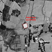
Location:
- Uzbekistan, Garang
- geo:37.537247,67.48394
- Location ± 0-5 m.
Class:
- Archaeological observation
- visible
Identifiers:
- vici:place=97569
Annotations
Nearby
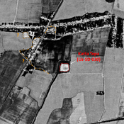
Unidentified site
Probable archaeological site. Rectangular mound, visible on Corona imagery (1970), since destroyed by modern cultivation.
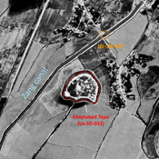
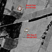
Katta Tepa (Uz-SD-030) (1 km)
Early Medieval, post-Mongol and pre-Modern settlement. Square elevated site (0,9 ha), formally surrounded by a an outer wall and lower area (small hills), mostly destroyed by cultivation by 1970. Studied by Arshavskaja and Rtveladze.
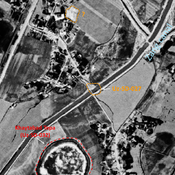
Dzhar Tepe (Uz-SD-338) (1 km)
Yuezhi and Kushan settlement. Remaining mound (0,2 ha), half destroyed by riverine erosion when the Surkhan Darya reached it. Studied by Pidaev.