
STRIDE, S. (2004), La Géographie archéologique de la province du Surkhan Darya (Bactriane du Nord, Ouzbekistan du Sud). Unpublished dissertation at the Université panthéon-Sorbonne (Paris), 5 vols. ( https://sirisacademic.academia.edu/SebastianStride?swp=tc-au-44230952 )
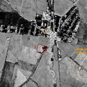
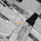
 - UZB-SD_1970_Kosh Tepe 1 495")
Surroundings:


Location:
- Uzbekistan, Khodzha-Khayat
- geo:38.348015,67.84404
- Location ± 0-5 m.
Period or year:
- -1xx / 7xx
Class:
- Rural settlement
- invisible
Identifiers:
- vici:place=97317
Annotations
Nearby
Unidentified site
Probable archaeological site. Located with satellite imagery.
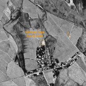
Unidentified site (1 km)
Probable archaeological site. Oval mound, visible on Corona imagery (1970), since leveled and destroyed by urbanisation.
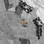
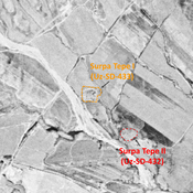
Khirman Tepe (Uz-SD-410) (1 km)
Medieval Islamic settlement (0,5 ha). Partially destroyed by modern construction and cultivation.