


STRIDE, S. (2004), La Géographie archéologique de la province du Surkhan Darya (Bactriane du Nord, Ouzbekistan du Sud). Unpublished dissertation at the Université panthéon-Sorbonne (Paris), 5 vols. ( https://sirisacademic.academia.edu/SebastianStride?swp=tc-au-44230952 )
")
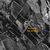
Location:
- Uzbekistan, Xolchayon
- geo:38.304859,67.980759
- Location ± 0-5 m.
Period or year:
- 10~ / 1xx
Class:
- Building (other)
- invisible
Identifiers:
- vici:place=97282
Annotations
Nearby
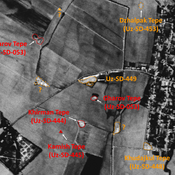
Unidentified site
Probable settlement. Located with satellite imagery.
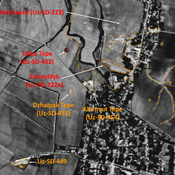
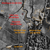
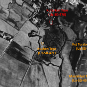
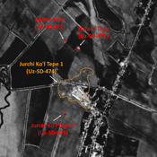
Khalchayan (Uz-SD-222)
Late Iron Age (Achaemenid), Hellenistic, Kushan and Kushano-Sassanian large settlement (16 - 40 ha). Mostly destroyed, with some mounds remaining (Karabag Tepe). Partially excavated by G. Pugachenkova (1959-1963).
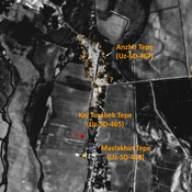
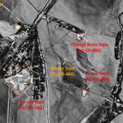
Koj Turabek Tepe (Uz-SD-465)
Late Iron Age (Achaemenid?), Hellenistic, Yuezhi and Kushan settlement. Elongated mound (0,35 ha), visible on Corona imagery (1970), since destroyed by modern urbanisation. Surveyed by MAFOuz.