
STRIDE, S. (2004), La Géographie archéologique de la province du Surkhan Darya (Bactriane du Nord, Ouzbekistan du Sud). Unpublished dissertation at the Université panthéon-Sorbonne (Paris), 5 vols. ( https://sirisacademic.academia.edu/SebastianStride?swp=tc-au-44230952 )
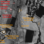
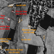
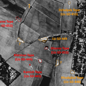
 - UZB-SD_1970_Dzhar Tepe 438")
Surroundings:


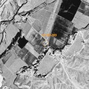


Location:
- Uzbekistan, O‘rtaqishloq
- geo:38.250401,67.942703
- Location ± 0-5 m.
Period or year:
- 9xx / 10xx
Class:
- Rural settlement
- invisible
Identifiers:
- vici:place=97267
Annotations
Nearby
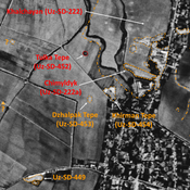
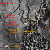
Kochkor Tepe II (Uz-SD-437)
Early Medieval and Pre-Mongol Medieval Islamic settlement. Noticable mound on Corona imagery (1970), since destroyed by modern activities. Surveyed by MAFOuz.
Unidentified site
Probable archaeological site. Northern part destroyed by urbanisation, but visible on Corona imagery (1970).
Kochkor Tepe (Uz-SD-436) (1 km)
Medieval Islamic settlement (1 ha). Formelly larger, but destroyed by modern cultivation. Studied by MAFOuz.