
STRIDE, S. (2004), La Géographie archéologique de la province du Surkhan Darya (Bactriane du Nord, Ouzbekistan du Sud). Unpublished dissertation at the Université panthéon-Sorbonne (Paris), 5 vols. ( https://sirisacademic.academia.edu/SebastianStride?swp=tc-au-44230952 )
 - UZB-SD_1970_Urdak Tepe 390")
Surroundings:


Location:
- Uzbekistan, Pistamazar
- geo:38.280193,67.933083
- Location ± 0-5 m.
Period or year:
- 10xx / 11xx
Class:
- Rural settlement
- invisible
Identifiers:
- vici:place=97237
Annotations
Nearby
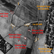
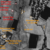
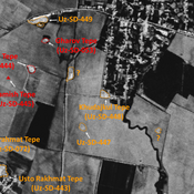
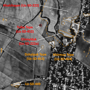
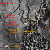
Mazarat Tepe (Uz-SD-068)
High Medieval and post-Mongol settlement (1 ha). Occupied nowdays by a cemetery. Studied by Arshavskaja & Rtveladze, and MAFOuz.
Gul' Asal Tepe I (Uz-SD-415) (1 km)
Also known as Mazarat Tepe and Charkhana Tepe. Kushan and Medieval Islamic settlement. Probable citadel (0,7 ha) of a larger urban area, already destroyed by 1950, whose some limits might be guessed on Corona imagery (1970). Studied by MAFOuz.
Unidentified site (1 km)
Probable archaeological site. Square mound, visible on Corona imagery (1970), since destroyed by modern cultivation.