


STRIDE, S. (2004), La Géographie archéologique de la province du Surkhan Darya (Bactriane du Nord, Ouzbekistan du Sud). Unpublished dissertation at the Université panthéon-Sorbonne (Paris), 5 vols. ( https://sirisacademic.academia.edu/SebastianStride?swp=tc-au-44230952 )

Location:
- Uzbekistan, Jamatak
- geo:38.228542,67.797188
- Location ± 0-5 m.
Period or year:
- 2xx? / unknown
Class:
- Grave or burial field
- visible
Identifiers:
- vici:place=97018
Annotations
Nearby
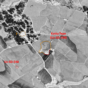
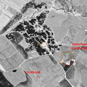
Unidentified site
Probable archaeological site. Mound, visible on Corona imagery (1970), since destroyed by modern construction.
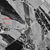
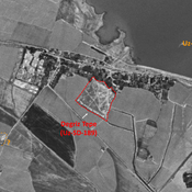
Eski Kabriston Ikras Tepe (Uz-SD-555) (1 km)
Medieval Islamic settlement. Rectangular site (0,2 ha), under an old cemetery, covered by vegetation. Surveyed by MAFOuz.
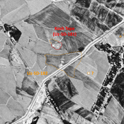
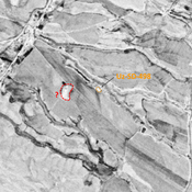
Unidentified site (1 km)
Probable archaeological site. Cluster of mounds, visible on Corona imagery (1970), since destroyed by urbanisation.