Vici.org
No images available yet. Please add images related to this place.

Surroundings:

UZB-SD_1970_Chipjon Tepe 477UZB-SD_1970_Ak Kurgan 035UZB-SD_1970_Guri Tepe 489UZB-SD_1970_Pes Tepe 2 479UZB-SD_1970_AS 431 (Binokor)UZB-SD_1970_AS 421 (Binokor)UZB-SD_1970_AS 425 (Binokor)UZB-SD_1970_AS 493 (Keneges)UZB-SD_1970_Kul' Tepe 481UZB-SD_1970_Jurchi Ko'l Tepe 1 474UZB-SD_1970_Majda Tepe 464UZB-SD_1970_Tursun Tepe 461UZB-SD_1970_Guraz Tepe (Uz-SD-092)UZB-SD_1970_Khirman Tepe 410UZB-SD_1970_AS 457 (Ishan)UZB-SD_1970_AS 416 (Andijon)UZB-SD_1970_Kosh Tepe 1 495UZB-SD_1970_Khuson Tepe 471UZB-SD_1970_US (Oqlar 1)UZB-SD_1970_AS 407 (Denov)UZB-SD_1970_Koj Turabek Tepe 465UZB-SD_1970_US-D (Karakan 1)UZB-SD_1970_Chimkurgan 082UZB-SD_1970_Gul' Asal 415UZB-SD_1970_Kurgancha 067UZB-SD_1970_Kuzali Tepe 491UZB-SD_1970_Khalchayan 222KhalchayanUZB-SD_1970_Dzhalpak Tepe 453UZB-SD_1970_US-D (Karakan 2)

Location:

  • Uzbekistan, Tash-Kurgan
  • geo:38.365646,67.923866
  • Location ± 0-5 m.

Period or year:

  • 9xx / 11xx

Class:

  • Rural settlement
  • visible

Identifiers:

  • vici:place=96999

Annotations


Nearby

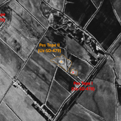
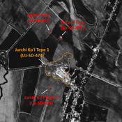
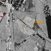
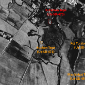
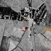
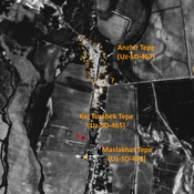
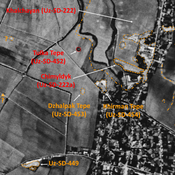
Nukhatak Tepe (Uz-SD-485)

Undated settlement. Rectangular mound (0,2 ha), surveyed by MAFOuz.

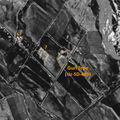
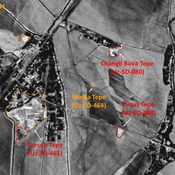
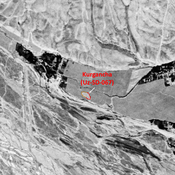
Gulistan Tepe (Uz-SD6486) (1 km)

Pre-Mongol Medieval Islamic site (0,04 ha). Visible on 1950 topographical maps, but already destroyed by 1970. Surveyed by MAFOuz.

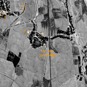
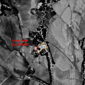
Unidentified site (1 km)

Probable settlement. Located with satellite imagery.


This object was added by Julien De Chocqueuse on 2024-06-09. Last update by Julien De Chocqueuse on 2024-06-09. Persistent URI: http://vici.org/vici/96999 . Download as RDF/XML, KML.
Annotation available using the Creative Commons Attribution-ShareAlike 3.0 Unported license. Metadata available using the Creative Commons Public Domain Dedication, unless it is explicitly stated otherwise.

Vici.org partners:

Livius.org: articles on ancient history   Rijksmuseum van Oudheden