
STRIDE, S. (2004), La Géographie archéologique de la province du Surkhan Darya (Bactriane du Nord, Ouzbekistan du Sud). Unpublished dissertation at the Université panthéon-Sorbonne (Paris), 5 vols. ( https://sirisacademic.academia.edu/SebastianStride?swp=tc-au-44230952 )
")
Location:
- ,
- geo:37.594219,67.458839
- Location ± 0-5 m.
Period or year:
- 4xx? / 8xx?
Class:
- Building (other)
- invisible
Identifiers:
- vici:place=96919
Annotations
Nearby
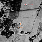
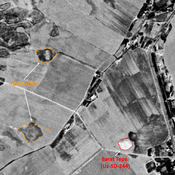
Unidentified site (Khor Dingak?)
Probable settlement. Located with satellite imagery.
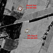
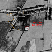
Bay Tepa III (Uz-SD-247) (2 km)
kushan settlement (0,9 ha). Badly damaged by modern cultivation. Studied by Rtveladze and Khakimov.
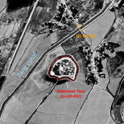
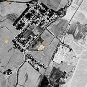
Bay Tepa IV (Uz-SD-246) (2 km)
Late (?) Iron Age to High Medieval settlement. Former tepa, leveled by ploughing in the second half of the 22th c, but visible on Corona imagery. Studied by Rteveladze and Kharimov (1973). Indication of monumental architecture.