
STRIDE, S. (2004), La Géographie archéologique de la province du Surkhan Darya (Bactriane du Nord, Ouzbekistan du Sud). Unpublished dissertation at the Université panthéon-Sorbonne (Paris), 5 vols. ( https://sirisacademic.academia.edu/SebastianStride?swp=tc-au-44230952 )

Location:
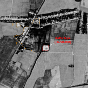
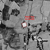
- Uzbekistan, Garang
- geo:37.542252,67.468292
- Location ± 0-5 m.
Period or year:
- -1xx / 3xx~
Class:
- Rural settlement
- visible
Identifiers:
- vici:place=96915
Annotations
Nearby
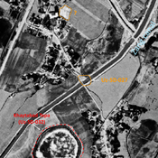
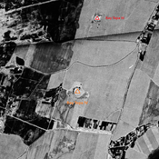
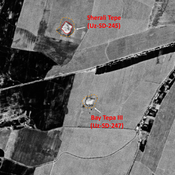
Unidentified site (1 km)
Probable archaeological site. Located with satellite imagery.
Unidentified site (1 km)
Probable archaeological site. Located with satellite imagery.
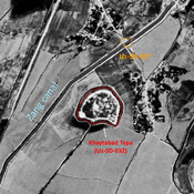
Katta Tepa (Uz-SD-030) (1 km)
Early Medieval, post-Mongol and pre-Modern settlement. Square elevated site (0,9 ha), formally surrounded by a an outer wall and lower area (small hills), mostly destroyed by cultivation by 1970. Studied by Arshavskaja and Rtveladze.