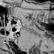
Vici.org
No images available yet. Please add images related to this place.

Surroundings:

Gorintepa (SO-019)_1970_Corona imageryKoshtepa 2 (SO-169)_1970_Corona imageryKattatepa main mound (SO-010)_1970_Corona imageryUnidentified site (Chuqurko'l 1)_1970_Corona imageryAnonymous settlement (SO-097)_1970_Corona imageryShortepa (SO-016)_1970_Corona imageryKurgan (SO-94,95,96)_1970_Corona imageryKishlok Bazar Kabristoni (SO-128)_1970_Corona imageryUnidentified site (Sokhta 1)_Corona imageryShortepa (SO-040)_1970_Corona imageryYalangoyoq ota tepa (SO-026)_1970_Corona imagery

Location:

  • Uzbekistan, Go‘ro‘n
  • geo:37.703911,67.073082
  • Location ± 0-5 m.

Class:

  • Archaeological observation
  • visible

Identifiers:

  • vici:place=96701

Annotations


Nearby

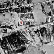
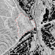
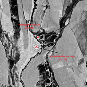
Gorintepa (SO-019) (Uz-SD-151)

Also known as Giljamob Tepe. Kushan & Kushano-Sasanian and Early Medieval settlement (0,7 ha). Surveyed by Danielisova (2009).
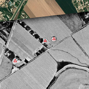
Pastaktepa (SO-122)

Hellenistic and High Medieval small mound (12x10m). Destroyed by modern cultivation, but visible on Corona imagery.

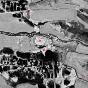
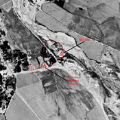
Koshtepa 1 (SO-021) (Uz-SD-234) (1 km)

Kushan & Kushano-Sasanian settlement (0,46 ha). Studied by Rtveladze & Khakimov, and surveyed by Stanco (2008).


This object was added by Julien De Chocqueuse on 2024-05-21. Last update by Julien De Chocqueuse on 2024-05-21. Persistent URI: http://vici.org/vici/96701 . Download as RDF/XML, GeoJSON, KML.
Annotation available using the Creative Commons Attribution-ShareAlike 3.0 Unported license. Metadata available using the Creative Commons Public Domain Dedication, unless it is explicitly stated otherwise.

Vici.org partners:

Livius.org: articles on ancient history   Rijksmuseum van Oudheden