
STRIDE, S. (2004), La Géographie archéologique de la province du Surkhan Darya (Bactriane du Nord, Ouzbekistan du Sud). Unpublished dissertation at the Université panthéon-Sorbonne (Paris), 5 vols. ( https://sirisacademic.academia.edu/SebastianStride?swp=tc-au-44230952 )

Location:
- Uzbekistan, Degikalyandar
- geo:38.452141,67.930092
- Location ± 0-5 m.
Period or year:
- 8xx / 12xx
Class:
- Rural settlement
- visible
Identifiers:
- vici:place=96672
Annotations
Nearby
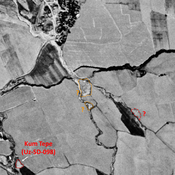
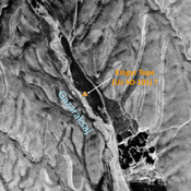
Tortuli Tepe (Uz-SD-106)
High Medieval and pre-Modern settlement (0,5 ha). Studied by Arshavskaja & Rtveladze. Destroyed by modern construction and not clearly visible on Corona imagery (1970).
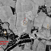
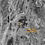
Unidentified site (1 km)
Probable archeological site. Mound visible on Corona imagery (1970), since destroyed by modern construction.
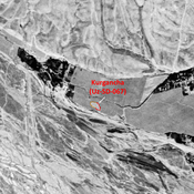
Unidentified site (1 km)
Probable archaeological site. Small square mound, visible on Corona imagery (1970), since destroyed by urbanisation.