


STRIDE, S. (2004), La Géographie archéologique de la province du Surkhan Darya (Bactriane du Nord, Ouzbekistan du Sud). Unpublished dissertation at the Université panthéon-Sorbonne (Paris), 5 vols. ( https://sirisacademic.academia.edu/SebastianStride?swp=tc-au-44230952 )
")
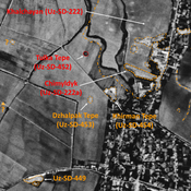
Location:
- Uzbekistan, Denov
- geo:38.284206,67.908691
- Location ± 0-5 m.
Period or year:
- 9xx / 12xx
Class:
- Building (other)
- invisible
Identifiers:
- vici:place=96599
Annotations
Nearby
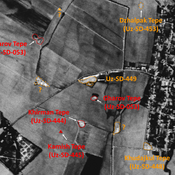
Anonymous site (Uz-SD-378) (1 km)
Small mound (1 ha), covered and damaged by modern housing. Reported by Stride. No datation information.
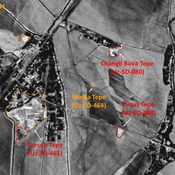
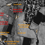
Gul' Asal Tepe I (Uz-SD-415) (1 km)
Also known as Mazarat Tepe and Charkhana Tepe. Kushan and Medieval Islamic settlement. Probable citadel (0,7 ha) of a larger urban area, already destroyed by 1950, whose some limits might be guessed on Corona imagery (1970). Studied by MAFOuz.
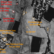
Anonymous site (Uz-SD-376) (1 km)
Undated site. Small mound (10x10m), possibly part of a larger site, destroyed by modern urbanisation. Surveyed by MAFOuz.