
STRIDE, S. (2004), La Géographie archéologique de la province du Surkhan Darya (Bactriane du Nord, Ouzbekistan du Sud). Unpublished dissertation at the Université panthéon-Sorbonne (Paris), 5 vols. ( https://sirisacademic.academia.edu/SebastianStride?swp=tc-au-44230952 )
 - UZB-SD_1970_Ak Kurgan 035")
Surroundings:


Location:
- Uzbekistan, Yurchi
- geo:38.331646,67.922363
- Location ± 0-5 m.
Period or year:
- 6xx / 17xx~
Class:
- Vicus or canabae
- visible
Identifiers:
- vici:place=96594
Annotations
Nearby
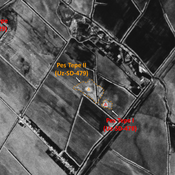
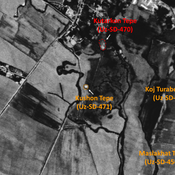
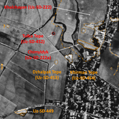
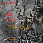
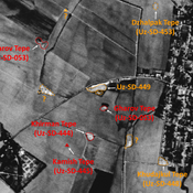
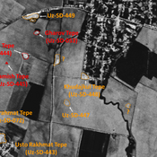
Toshbaqa Tepe (Uz-SD-423)
Medieval Islamic site (0,15 ha. Small mound, a probable western extension of the larger Ak-Kurgan settlement. Badly damaged by modern cultivation.
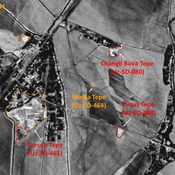
Shait Bobo Tepe (Uz-SD-428)
Medieval Islamic settlement. Consisting of a southern and northern hills, badly damaged.
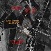
Ghizlargan Tepe (Uz-SD-422)
Medieval Islamic settlement (0,2 ha). Almost completely destroyed by modern urbanisation, but visible on Corona imagery (1970). Surveyed by MAFOuz.