Vici.org

Surroundings:

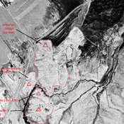
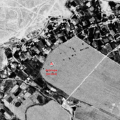
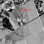
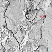
Khalinchaktepa (SO-055)_1970_Corona imageryJarkurtan citadel (SO-069)_1970_Corona imageryUZB_SD_1970_Corona image_Anjirtepa (SO-054)Mozoroti baba tepa (SO-024)_1970_Corona imagery

Location:

  • Uzbekistan, Talishkan
  • geo:37.585148,66.914703
  • Location ± 0-5 m.

Period or year:

  • 10~ / 12xx

Class:

  • City
  • visible

Identifiers:

  • vici:place=96205

Annotations

STANCO Ladsilav (2020), Sherabad Oasis - Tracing Historical Landscape in Southern Uzbekistan, Karolinum, Nakladatelstvi Univerzity Karlovy,Czech Republic

ARSHAVSKAYA et al. (1982) = Arshavskaya, Z. A. – Rtveladze, E. V. – Khakimov, Z. A., Srednevekovye pamyatniki Surkhandar’i. Tashkent

STRIDE, S. (2004), La Géographie archéologique de la province du Surkhan Darya (Bactriane du Nord, Ouzbekistan du Sud). Unpublished dissertation at the Université panthéon-Sorbonne (Paris), 5 vols.


Nearby

Anonymous settlement (SO-136)

Early Medieval settlement. Small mound, destroyed by modern cultivation, but visible on Corona imagery.

Talashkantepa II (SO-032) (Uz-SD-228) (1 km)

Kushan & Kushano-Sasanian, and Early Medieval settlement (4,8 ha). Pentagonal mound. Surveyed by Stanco (2005, 2010).

Talashkantepa II (SO-072) (Uz-SD-228) (1 km)

Post-mongol north western mound of Talashkantepa II. Surveyed by Stanco (2005, 2010).


This object was added by Julien De Chocqueuse on 2024-04-10. Last update by Julien De Chocqueuse on 2024-05-21. Persistent URI: http://vici.org/vici/96205 . Download as RDF/XML, GeoJSON, KML.
Annotation available using the Creative Commons Attribution-ShareAlike 3.0 Unported license. Metadata available using the Creative Commons Public Domain Dedication, unless it is explicitly stated otherwise.
Line tracing by Julien De Chocqueuse.

Vici.org partners:

Livius.org: articles on ancient history   Rijksmuseum van Oudheden