
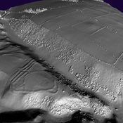
https://lidarfinder.com/?fbclid=IwAR3KH-8GemPlyfLDwagMx8r8Rl8qmnVIH6HZDP_Reu05DmygfJiukCy_p_k

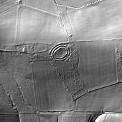
Location:
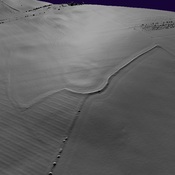
- United Kingdom of Great Britain and Northern Ireland, Earle
- geo:55.535408,-2.027621
- Location ± 0-5 m.
Period or year:
- -4xx / unknown
Class:
- Rural settlement
- visible
Identifiers:
- vici:place=95536
Annotations
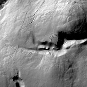
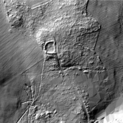
Nearby
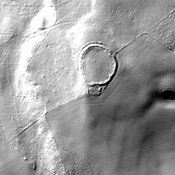
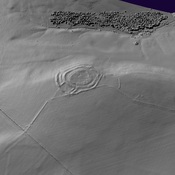
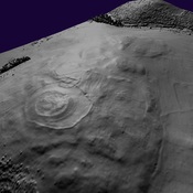
Wooler
Iron Age Settlement
Iron Age Settlement (1 km)
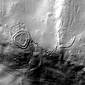
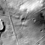
Iron Age Settlement
Homildon Hill - Humbleton Hill (2 km)
Iron Age hillfort