
No annotations have been added. Please add information about this place.

Surroundings:
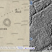

Location:
- United Kingdom of Great Britain and Northern Ireland, Ruthin
- geo:53.115196,-3.358317
- Location ± 0-5 m.
Period or year:
- -4xxx? / unknown
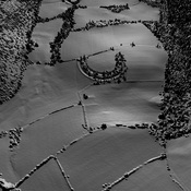
Class:
- Rural settlement
- visible
Identifiers:
- vici:place=93564
Annotations
Nearby
Y Garth camp (1 km)
Iron Age settlement.
Ruthin Fort (3 km)
Ruthin Fort
Moel Y Gaer (6 km)
IA Settlement.