
WENKE Robert J. (1975), Imperial investments and agricultural developments in Parthian and Sassanian Khuzestan, 150 B. C. to A. D. 640 (https://www.academia.edu/35337300/Imperial_Investments_and_Agricultural_Developments_in_Parthian_and_Sassanian_Khuzestan_Iran_)

Location:
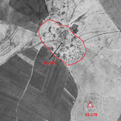
- Iran (Islamic Republic of), Chamgom Chapī
- geo:32.214981,48.626862
- Location ± 0-5 m.
Period or year:
- 25~ / 250~
Class:
- Rural settlement
- invisible
Identifiers:
- vici:place=86696
Annotations
Nearby
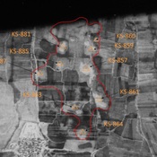
Anonymous settlement (KS-851-864, 881-887) (1 km)
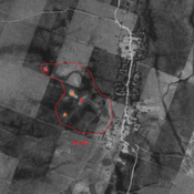
Seleuco-Parthian, middle & terminal Parthian, and early Sassanian settlement. Cluster of mounds, leveled and destroyed by modern agriculture, but visible on CORONA imagery.
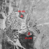
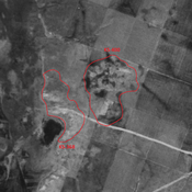
Anonymous settlement (KS-102) (2 km)
Late Susiana I, Susa I settlement, late Uruk and Susa III settlement (1,2 ha).
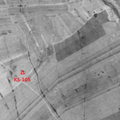
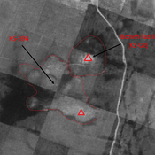
Unidentified site (2 km)
Probable settlement. Single-mound, destroyed by modern agriculture and irrigation, but visible on CORONA imagery.