Vici.org
No images available yet. Please add images related to this place.

Surroundings:

Iran_Susiana_Unidentified (Şīḩeh) - CORONA imageryIran_Susiana_Unidentified (Gonjeh) - CORONA imageryIran_Susiana_Tappeh Saiyeh (KS-08) - CORONA imageryIran_Susiana_Unidentified (Shahrak-e Emām Reẕā) - CORONA imageryIran_Susiana_Anonymous (KS-012) - CORONA imageryIran_Susiana_Unidentified (Dezfūl) - CORONA imageryIran_Susiana_Anonymous (KS-010) - CORONA imageryIran_Susiana_Tepe Tula'i (?) - CORONA imageryTappeh Senjar (KS-07) - CORONA ImageryIran_Susiana_Anonymous (KS-11) - CORONA imageryIran_Susiana_Unidentified (Dezfūl 2) - CORONA imageryIran_Susiana_Unidentified (Seyyed Karam) - CORONA imageryIran_Susiana_Anonymous (KS-15) - CORONA imageryIran_Susiana_Anonymous (KS-17) - CORONA imagery

Location:

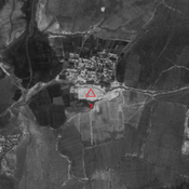
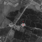
  • Iran (Islamic Republic of), Şīḩeh
  • geo:32.385303,48.262054
  • Location ± 0-5 m.

Period or year:

  • 25~ / 250~

Class:

  • Rural settlement
  • invisible

Identifiers:

  • vici:place=86554

Annotations


Nearby

Unidentified site

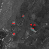
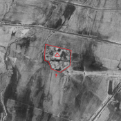
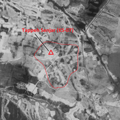
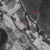
Probable settlement. Large site, destroyed by modern agriculture. But visible on CORONA imagery.

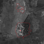
Unidentified site (1 km)

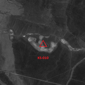
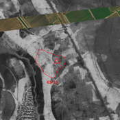
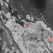
Probable settlement. Single-mound site, destroyed by modern agriculture. But visible on CORONA imagery.

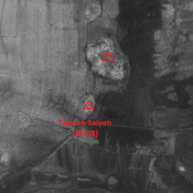
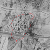
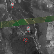
Anonymous settlement (KS-391) (1 km)

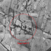
Sasanian and Early Medieval Islamic settlement (25 ha). Large site, destroyed by modern agriculture. But visible on CORONA imagery.


This object was added by Julien De Chocqueuse on 2023-05-23. Last update by Julien De Chocqueuse on 2023-05-23. Persistent URI: http://vici.org/vici/86554 . Download as RDF/XML, GeoJSON, KML.
Annotation available using the Creative Commons Attribution-ShareAlike 3.0 Unported license. Metadata available using the Creative Commons Public Domain Dedication, unless it is explicitly stated otherwise.

Vici.org partners:

Livius.org: articles on ancient history   Rijksmuseum van Oudheden