Vici.org
No images available yet. Please add images related to this place.

Surroundings:

Iran_Susiana_Anonymous (KS-012) - CORONA imageryIran_Susiana_Unidentified (Gonjeh) - CORONA imageryIran_Susiana_Anonymous (KS-010) - CORONA imageryIran_Susiana_Tappeh Saiyeh (KS-08) - CORONA imageryIran_Susiana_Unidentified (Şīḩeh) - CORONA imageryIran_Susiana_Unidentified (Shahrak-e Emām Reẕā) - CORONA imageryIran_Susiana_Anonymous (KS-11) - CORONA imageryIran_Susiana_Unidentified (Dezfūl) - CORONA imageryIran_Susiana_Anonymous (KS-15) - CORONA imageryTappeh Senjar (KS-07) - CORONA ImageryIran_Susiana_Anonymous (KS-17) - CORONA imageryIran_Susiana_Unidentified (Seyyed Karam) - CORONA imageryIran_Susiana_Tepe Tula'i (?) - CORONA imageryIran_Susiana_Unidentified (Hormozīn) - CORONA imageryIran_Susiana_Unidentified (Dezfūl 2) - CORONA imageryIran_Susiana_Unidentified (Chīchālī Do) - CORONA imagery

Location:

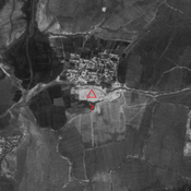
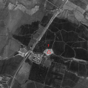
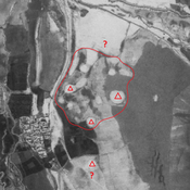
  • Iran (Islamic Republic of), Da‘ījī-ye Qoţb
  • geo:32.361195,48.262478
  • Location ± 0-5 m.

Period or year:

  • 6xx / 10xx

Class:

  • Rural settlement
  • visible

Identifiers:

  • vici:place=86544

Annotations


Nearby

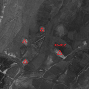
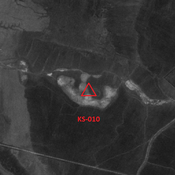
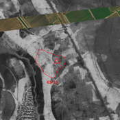
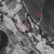
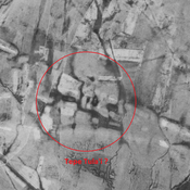
Anonymous settlement (KS-1010)

Terminal Parthian and early Sasanian site. Destroyed by modern agriculture. But visible on CORONA imagery.

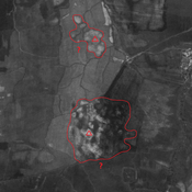
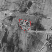
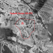
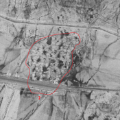
Anonymous settlement (KS-434)

Terminal Parthian and early Sasanian settlement. Destroyed by modern agriculture. But visible on CORONA imagery.
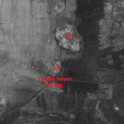
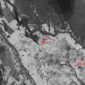
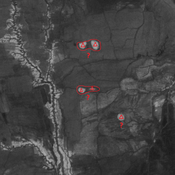
Unidentified site

Probable settlement. Located with satellite imagery.


This object was added by Julien De Chocqueuse on 2023-05-22. Last update by Julien De Chocqueuse on 2023-05-22. Persistent URI: http://vici.org/vici/86544 . Download as RDF/XML, GeoJSON, KML.
Annotation available using the Creative Commons Attribution-ShareAlike 3.0 Unported license. Metadata available using the Creative Commons Public Domain Dedication, unless it is explicitly stated otherwise.

Vici.org partners:

Livius.org: articles on ancient history   Rijksmuseum van Oudheden