
WENKE Robert J. (1975), Imperial investments and agricultural developments in Parthian and Sassanian Khuzestan, 150 B. C. to A. D. 640 (https://www.academia.edu/35337300/Imperial_Investments_and_Agricultural_Developments_in_Parthian_and_Sassanian_Khuzestan_Iran_)
 - CORONA imagery")
Surroundings:
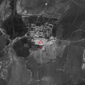

Location:
- Iran (Islamic Republic of), Dezfūl
- geo:32.404392,48.194481
- Location ± 0-5 m.
Period or year:
- 25~ / 10xx
Class:
- Vicus or canabae
- invisible
Identifiers:
- vici:place=86477
Annotations
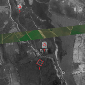
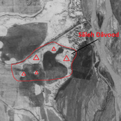
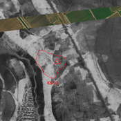
Nearby
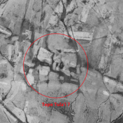
Anonymous settlement (KS-370) (1 km)
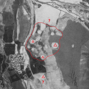
Sasanian settlement. Destroyed by agriculture, but visible on CORONA imagery.
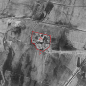
Tepe Tula'i (KS-372) (1 km)
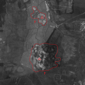
Neolithic nomadic campsite and early Sasanian settlement. Destroyed by modern irrigation and agriculture, but visible on CORONA imagery.
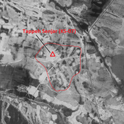
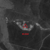
Anonymous settlement (KS-554) (1 km)
Late Sasanian and early medieval Islamic settlement. Destroyed by agriculture, but visible on CORONA imagery.