
WENKE Robert J. (1975), Imperial investments and agricultural developments in Parthian and Sassanian Khuzestan, 150 B. C. to A. D. 640 (https://www.academia.edu/35337300/Imperial_Investments_and_Agricultural_Developments_in_Parthian_and_Sassanian_Khuzestan_Iran_)

Location:
- Iran (Islamic Republic of), Samandī-ye ‘Olyā
- geo:32.16571,48.611412
- Location ± 0-5 m.
Period or year:
- -5xx / 4xx
Class:
- Vicus or canabae
- invisible
Identifiers:
- vici:place=86145
Annotations
Nearby
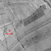
Anonymous settlement (KS-105) (1 km)
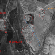
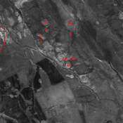
Late Susiana I and Susa I settlement (0,2 ha). Small single-mound site, destroyed by agriculture but visible on CORONA imagery.
Unidentified site (3 km)
Probable settlement. Single-mound, destroyed by modern agriculture and irrigation, but visible on CORONA imagery.
Anonymous settlement (KS-107) (3 km)
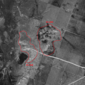
Early & Late Sasanian, and early medieval islamic city-size settlement. Outer portions damaged by modern agriculture.