
Source: Lyon Historique


Umgebung:


Lage:
- Frankreich, Francheville
- geo:45.721298,4.760103
- Lage ± 0-5 m.
Klassification:
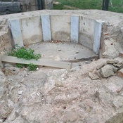
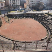
- Aquädukt
- Sichtbar
Identifiers:
- vici:place=7917
- romaq:aqueduct=156
- dare:place=393650
- wikidata:entity=Q3067
Anmerkungen
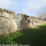
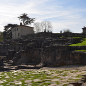
The Aqueduct of the Gier (French Aqueduc du Gier, Rive-du-Gier) was probably constructed in the 1st century CE to provide water for Lugdunum (Lyon). It is the longest and best preserved of four Roman aqueducts that served the growing capital of the Roman province of Gallia Lugdunensis. It drew its water from the source of the Gier, a small tributary of the Rhone, on the slopes of Mont Pilat, 42 km (26 mi) south-west of Lyon.
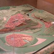
Following a sinuous path, at 85 km (53 mi) the aqueduct of the Gier is the longest known of the Roman aqueducts. Its route has been retraced in detail, following the numerous remains. Leaving the uplands of the massif du Pilat, department of the Loire, the aqueduct hugs the surface relief and crosses the department of the Rhone, passing through Mornant, Orliénas, Chaponost and Sainte-Foy-lès-Lyon to terminate at Lyon.1
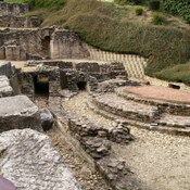
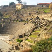
In its extent, it draws upon the whole repertory of Roman techniques of aqueduct building, taking a slope that averages 0.1%, or a meter every kilometer. There are 73 km (45 mi) of covered ditches laid with a concrete culvert 3 m (9.8 ft) high and 1.5 m (4.9 ft) wide, which is sunk as deep as 4 m (13 ft) beneath the land surface. The aqueduct passes through 11 tunnels, one of which, near Mornant, is 825 m (2,707 ft) in extent. Access for cleaning and repairs was through manholes at 77 m (253 ft) distances. There are some thirty stretches in the open air. There are ten stretches raised on walls and arches, which provide the most spectacular visible remains of the aqueduct.
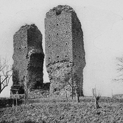
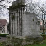
Four inverted siphon tunnels cross the particularly deep and wide river valleys of the Durèze, the Garon, the Yzeron and the Trion on pipe bridges raised on high arches. In these, water filled a sunken tank tower (castellum) on the brim of a slope. The tank effected a transition between open channel flow and a lead pipeline. From the castellum water was carried, now pressurized, in a set of airtight lead pipes laid side by side, with soldered joints, down the valley slope, across a bridge spanning the river—whose piers and arches are the most notable remains of the system—and up the facing slope, to a tank slightly lower than the head tank, losing just a little hydraulic head in the process. The inverted siphons obviated the bridging of deep valleys with arcade upon arcade of arches, as at Pont du Gard, which marks the limit of such a system.
The Gier aqueduct was built in a single great campaign, since no part of it could have served until it was completed; it must have taken years. The aqueduct of Giers was dated by Germain de Montauzon to the reign of Hadrian in the early 2nd century CE, but, as James Stephen Bromwich points out, its reticulated stonework (opus reticulatum) was characteristic of the later 1st century BCE and the first half of the 1st century CE, rather than of later masonry. In addition he notes that a recently excavated public fountain on the hill of Fourvières, datable about 50 CE could not have been supplied with water until the Giers aqueduct was complete.2
Source: Lyon Historique
Referenzen
Source: Lyon Historique
Mogelijk het langste Romeinse aquaduct.
Source: Lyon Historique
Relevante Museen
New York, Metropolitan Museum of Art
New York, Metropolitan Museum of Art
In der Nähe
Aqueduc romain du Gier (2 km)
Aqueduc romain du Gier
Roman Rd (3 km)
Roman Rd
Le Tourillon, Craponne (3 km)
Le Tourillon, Craponne