
Vici.org
Keine Bilder von diesem Ort. Bitte, Bilder hochladen.

Umgebung:

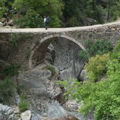
Roman Bridge

Lage:

  • Türkei, Göynük
  • geo:36.657269,30.482809
  • Genaue Lage

Period or year:

  • -4xx / unknown

Klassification:

  • Stadt
  • Sichtbar

Identifiers:

Anmerkungen

Es gibt noch keine deutschsprachige Anmerkungen. Präsentiert wirden Anmerkungen auf English.

Mnara was a centre of the Mnarike region that is mentioned on the Miliarium Lyciae. At the time of military conquest carried out by Alexander the Great’s troops, its name must have been corrupted to Marmara. During the Hellenistic period it  was an independent polis.

See:

  1. Lycian Monuments.  https://www.lycianmonuments.com/mnara/
  2. Northeast Lycia. The New Evidence- The Results from the past ten years from the Bey Mountains Surface Surveys. By NEVZAT ÇEVİK. p. 205 - 207    https://www.academia.edu/2486719/Northeast_Lycia_The_New_Evidence_The_Results_from_the_past_ten_years_from_the_Bey_Mountains_Surface_Surveys

In der Nähe

Temple of Artemis

Temple of Artemis

Gedelme Castle (6 km)

Ruins of Byzantine fortress at Kaderme

Roman Bridge (6 km)

Roman Bridge