
Vici.org
No images available yet. Please add images related to this place.

Surroundings:

Tell Duhaila

Location:

  • Iraq, Albū ‘Alī
  • geo:30.968611,45.789444
  • Location ± 0-5 m.

Period or year:

  • -1750~ / -1450~

Class:

  • City
  • visible

Identifiers:

  • vici:place=63932

Annotations

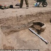
Tell Duhaila is a probable capital of the First Sealand Dynasty  (also named 2nd Dynasty of Babylon), which ruled the southernmost portion of Mesopotamia c. 1725-c. 1450 BC. The fortified settlement situated on the Eridu canal of the Euphrates appear to have been a significant administrative center. After the collapse of the city, part of the former settlement was used as a cemetery.

See:

  1.  Alexei I . Jankowski-Diakonoff, АРХЕОЛОГИЯ ДРЕВНЕГО ВОСТОКА, Results of the Test Season of the Iraqi-Russian Expedition at Tell Dehaila-1, 2020
  2. Russian archaeologists found 4,000-old city in Iraqm https://en.vestikavkaza.ru/articles/Russian-archaeologists-found-4-000-old-city-in-Iraq.html
  3. Odette Boivin, The First Dynasty of the Sealand in Mesopotamia, Walter de Gruyter 2018, pp. 23, 68

Nearby

Tell Duhaila

Tell Duhaila. Tell Dehaila (Tall Dahaylah). Tell al-Duhaila.

Unidentified site (5 km)

Probable archaeological site. Located with satellite imagery.

Unidentified site (5 km)

Probable archaeological site. Located with satellite imagery.


This object was added by Elżbieta on 2020-02-09. Last update by Elżbieta on 2022-01-28. Persistent URI: http://vici.org/vici/63932 . Download as RDF/XML, KML.
Annotation available using the Creative Commons Attribution-ShareAlike 3.0 Unported license. Metadata available using the Creative Commons Public Domain Dedication, unless it is explicitly stated otherwise.

Vici.org partners:

Livius.org: articles on ancient history   Rijksmuseum van Oudheden