
News: https://www.archaeopublica.eu/verein/projekte/survey-sankt-pantaleon/

Surroundings:
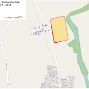

Location:
- Austria, Sankt Pantaleon
- geo:48.219421,14.566494
- Location ± 0-5 m.
Period or year:
- 70 / unknown
Class:
- Vicus or canabae
- invisible
Identifiers:
- vici:place=63069
Annotations
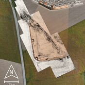
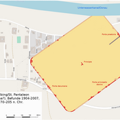
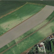
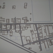
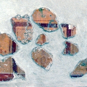
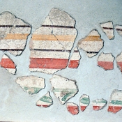
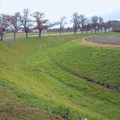
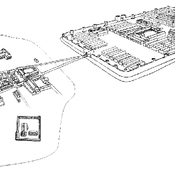
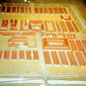
Das Lagerdorf des Hilfstruppenkastells breitete sich westlich davon aus. Bis dato konnten die Reste von Straßenzügen und langrechteckigen Gebäuden mit mehreren Räumen beobachtet werden, die nördlich und südlich einer Hauptstraße lagen und entweder von West nach Ost oder von Nord nach Süd ausgerichtet waren.
Relevant museums
Museum Lauriacum
Museum Lauriacum
Nearby
Limeskastell Stein - St. Pantaleon-Erla
Roman auxiliary fort dated to 1st/ 2nd century A.D.
Albing (1 km)
Albing - Fort; 30 BC - AD 300; Pleiades #118552
Milestone Wagram (CIL 17-04-01, no. 079) (1 km)
Milestone Wagram (CIL 17-04-01, no. 079), see http://oracle-vm.ku-eichstaett.de:8888/epigr/epieinzel_en?p_belegstelle=CIL+17-04-01,+00079. Data from http://francia.ahlfeldt.se/