
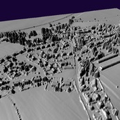
http://romanroads.org/gazetteer/cumbria/M75-files/papcastle-map-lidar.jpg

Location:
- United Kingdom of Great Britain and Northern Ireland, Papcastle
- geo:54.667782,-3.381565
- Location ± 0-5 m.
Period or year:
- 100 / unknown
Class:
- Road
- invisible
Identifiers:
- vici:place=57327
Annotations
Nearby
Roman Bridge
RomanBridge
Derventio Vicus
Derventio Vicus