Vici.org
No images available yet. Please add images related to this place.

Surroundings:

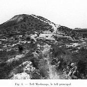
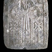
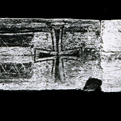
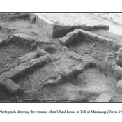
Tell MashnaqaTell MashnaqaThe marble panel found near the entrance of the monasteryBlack and white photograph of the Byzantine lintel found embedded under the Abbasid Period derage.

Location:

  • Syrian Arab Republic, Nahab
  • geo:36.348404,40.83654
  • Location uncertain

Period or year:

  • -3300 / -800

Class:

  • City
  • visible

Identifiers:

  • vici:place=41127

Annotations

The oldest evidence for a settlement at Tell Bderi dates from V th millennium BC.

See:

  1. Peter Pfadhner, The excavations at Tell Bderi 1986 in: AAAS 1986-87-  Les annales archéologiques arabes syriennes. Revue d'archéologie et d'histoire 36-37, pp. 292-303 - http://archiv.ub.uni-heidelberg.de/propylaeumdok/1283/1/Pfaelzner_The_excavations_at_Tell_Bderi_1986.pdf
  2. Peter Pfadhner, Tell Bderi - the development of a Bronze Age town, in: S. Kerner (eds.), The Near East in Antiquity. German contributions to the archaeology of Jordan, Palestine, Syria, Lebanon and Egypt, Amman 1990, pp. 63-79
  3. Peter M. M. G. Akkermans, Glenn M. Schwartz, The Archaeology of Syria: From Complex Hunter-Gatherers to Early Urban Societies (c.16,000-300 BC), CAH 2003, p.377

Nearby

Ṭābatum - Tell Taban (4 km)

Bronze Age town

Tabite-Thebetha?-Thebeta (4 km)

Tabite/Thebetha?/Thebeta

Tell Bderi (4 km)

Dur-Aššur-ketti-lešir. A town mentioned in Neo-Assyrian sources that is identified with modern Tell Bderi.


This object was added by Elżbieta on 2017-04-22. Last update by Elżbieta on 2017-04-22. Persistent URI: http://vici.org/vici/41127 . Download as RDF/XML, GeoJSON, KML.
Annotation available using the Creative Commons Attribution-ShareAlike 3.0 Unported license. Metadata available using the Creative Commons Public Domain Dedication, unless it is explicitly stated otherwise.

Vici.org partners:

Livius.org: articles on ancient history   Rijksmuseum van Oudheden