Vici.org
Keine Bilder von diesem Ort. Bitte, Bilder hochladen.

Umgebung:

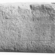
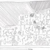
Çalapverdi I SteleÇalapverdi I Stele

Lage:

  • Türkei, Yoğunhisar
  • geo:39.290173,35.239731
  • Lage unsicher

Period or year:

  • -3000~ / unknown

Klassification:

  • Stadt
  • Sichtbar

Identifiers:

Anmerkungen

Es gibt noch keine deutschsprachige Anmerkungen. Präsentiert wirden Anmerkungen auf English.

Euesa/Euaissa/Seioua/Siva according to Barrington Atlas, 2000, p. 992 - location is uncertain.

Yoğunhisar Mound located within the borders of Yozgat Province, and southeast of the village of Yozgunhisar.   It measures approximately 150 x 60 meters and is 40 meters high. On the western slope of the mound, there are vaulted stone tunnels date to Hellenistic Period (most probably).

See:

  1. YOZGAT İL KÜLTÜR VE TURİZM MÜDÜRLÜĞÜ, https://yozgat.ktb.gov.tr/TR-92355/arkeolojik-sit-alanlari.html
  2. Yogunhisar, http://tayproject.org/TAYmaster.fm$Retrieve?YerlesmeNo=2930&html=masterEngDetail.html&layout=web
In der Nähe

Yoğunhisar Mound

Yoğunhisar Höyük.

Yoğunhisar

http://www.yozgatkulturturizm.gov.tr/TR,92355/arkeolojik-sit-alanlari.html

Akalan (Akhöyük) Tümülüsü

Hellenistic period tumulus.