

Il n'y a pas une annotation en français. Présenté est une annotation en Anglais.
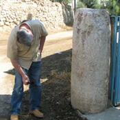
The fortifications of ancient and medieval Euchaita are located on the cliffs to the northeast of the modern village of Beyözü, whose previous name Avkat was derived from that of the old town. The very first records of Euchaita dates to the Roman period, when it was a village in the territory of Amasya the during the reign of Diocletian (198-230 ). Euchaita later Avkat seems to have been occupied since prehistoric times
See:
- H Elton, JF Haldon, J Newhard, S Lockwood, Avkat Archaeological Project, 2007-2008., Araştırma Sonuçları Toplantısı 27.3 (2009), pp. 29–51
- https://history.princeton.edu/centers-programs/center-collaborative-history/special-projects/past-projects/avkat/introduction