Vici.org
No images available yet. Please add images related to this place.

Surroundings:

Horse with saddle, Amuq Valley, Cüdeyde TellBettirBettirKhirbet HasanharencKfer. Plan of the chapel.Bamukka, church and baptisteryBashmishliBamukka, GraveByzantine chapel near BanakfurÜçtepe III MoundQalb Loze in SyriaKhirbet Tezin, West portalDehes, East Church. Portal in South wallSyriac inscription from baptistery of DehesBaqirha, Baptistery of the West ChurchBaqirha 2020

Location:

  • Türkiye, Yenişehir
  • geo:36.241238,36.569263
  • Location ± 25-100 m.

Period or year:

  • -60~ / unknown

Class:

  • Vicus or canabae
  • invisible

Identifiers:

Annotations


Nearby

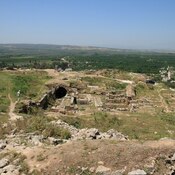
Tell Dahab (AS 177) (2 km)

Tal Dhahab. Amuq Survey site -AS 177.

Cüdeyde Höyük - Tell Judaidah (3 km)

Neolithic (6000 BC)settlement. Tell al-Judaidah. Tell el Cüdeyde Höyük - Cüdeyde Tepesi.

Cüdeyde Höyük - Tell Judaidah (3 km)

Archeological site near Reyhanlı/Hatay, Turkey. Tell al-Judaidah. Tell Judeideh.


This object was added by René Voorburg on 2012-05-29. Last update by Elżbieta on 2018-12-04. Persistent URI: http://vici.org/vici/2342 . Download as RDF/XML, GeoJSON, KML.
Annotation available using the Creative Commons Attribution-ShareAlike 3.0 Unported license. Metadata available using the Creative Commons Public Domain Dedication, unless it is explicitly stated otherwise.

Vici.org partners:

Livius.org: articles on ancient history   Rijksmuseum van Oudheden