

Es gibt noch keine deutschsprachige Anmerkungen. Präsentiert wirden Anmerkungen auf English.
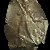
Kanesh consists of a tell, the actual Kültepe ( it means in Turkish Ash Hill) and a lower town - an Assyrian settlement. Its name in Assyrian texts from the 20th century BC was Kaneš (spoken: Kanesh). Later Hittites called Anisa or Neša, or occasionally Anisa. Kanesh became important trade colony because of its main location along natural trade routes. kanesh experienced its heyday was in the 1900’s and 1800’s BC. Hittities conquered and burned city in 1740 .
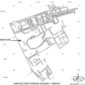
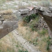
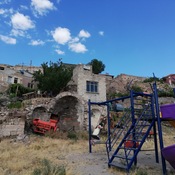
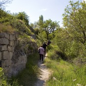
The Upper City was a government and religious center of Kaneshsurrounded with large protection wall .
- J Mellaart, Anatolian Chronology in the Early and Middle Bronze Age, 1957, Anatolian Studies, vol.7, pp.55-88
- Seton Lloyd, Early Ancient People of Anatolia, london 1967 pp.45-563.
- idem, Ancient Turkey. A Traveler;s History, London 1989 pp.24-27.
- Trevor Bryce, The Kingdom of the Hittites, rev, ed, 2005.
- Tahsin Özgüç, The Palaces and Temples of Kultepe-Kanis/Nesa, Turk Tarih Kurumu Basimevi, 1999
- Subartu XXXV KIM 1 Proceedings of the 1 st Kültepe International Meeting Kültepe 19-23 September, 2013, Studies dedicated to Kutlu Emre, Brepols Publishers 2015
- Gojko Barjamovic, ‘Kültepe after Kaneš,’ in F. Kulakoglu and C. Michel (eds) Proceedings of the 1st Kültepe International Meeting. (Kültepe International Meetings 1, Subartu 35). Brepols: Turnhout. pp. 233-242
- Maciej Makowski, The Road to the Citadel of Kanesh. Urban Structure and Spatial Organization of the City during the Assyrian Colony Period, in: Proceedings of the 8th International Congress on the Archaeology of the Ancient Near East 30 April – 4 May 2012, University of Warsaw Volume 1, 2014, pp. 93-111