
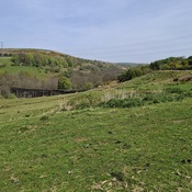


Location:
- United Kingdom of Great Britain and Northern Ireland, Edgworth
- geo:53.644592,-2.393524
- Location ± 0-5 m.
Period or year:
- 150 / unknown
Class:
- Road
- visible
Identifiers:
- vici:place=19729
Annotations
Nearby
Wayoh Fort (1 km)
LiDAR has provided that positive conclusion and clearly visible is the probable outline of a small fort with double ditches on 3 sides, single ditch on the road side and 3 rounded corners.
Hogshead Law Hill (16 km)
Neolithic settlement.
Tooter Hill (16 km)
Neolithic settlement.