
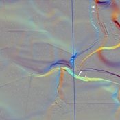
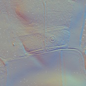
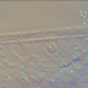
Diese Straße zeigt deutlich auf der Canmore Kartierung, mit vielen Referenzen. Die Spuren oder Dämme sind an vielen Stellen sichtbar.

Location:
- United Kingdom of Great Britain and Northern Ireland, Muthill
- geo:56.338543,-3.793772
- Location ± 25-100 m.
Class:
- Road
- visible
Identifiers:
- vici:place=13503
Annotations
Diese Straße zeigt deutlich auf der Canmore Kartierung, mit vielen Referenzen. Die Spuren oder Dämme sind an vielen Stellen sichtbar.
Nearby
Strageath Cottage Temporary Camp
Strageath Cottage Temporary Camp
Strageath Roman Fort
Strageath Roman Fort
Innerpeffray West Temporary Camp (1 km)
Innerpeffray West Temporary Camp