
")
")
")
")
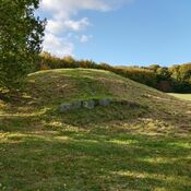
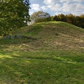

Gammel Hestehave Mound 411710 is identified as a Neolithic and Bronze Age site, specifically a Round Barrow (Rundhøj). The mound dates generally to the bronze age. The site is also known by the alternative name Gamle Hestehauge.
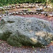
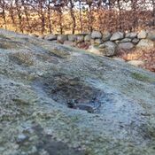
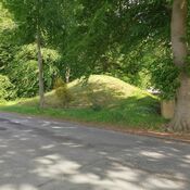
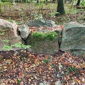
The monument is situated in Denmark, within the area of Fyn, and is administratively located in Svendborg Kommune (municipality). Svendborg is the nearest town. The Gammel Hestehave mound 411710 is the largest and best preserved of all the burial mounds in the local area. It forms part of a larger group of mounds designated as a sightseeing mound group. Other nearby ancient sites include numerous other round barrows, a Cist (Stenkiste), and Rock Art (such as Gammel Hestehave Æbleskivestenen).
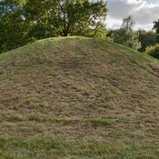
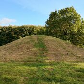
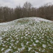
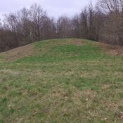
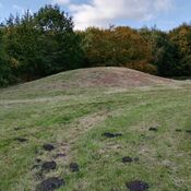
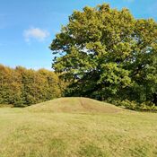
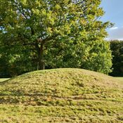
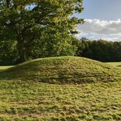
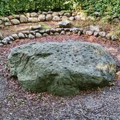
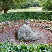
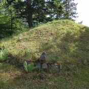
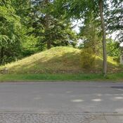
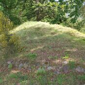
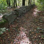
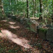
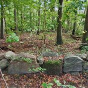
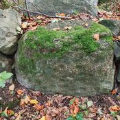
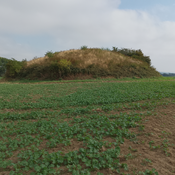
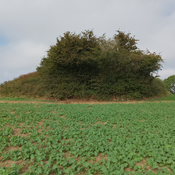
The mound is described as »well-preserved«. It has a total height of 3.80 meters and a diameter of 28 meters. Historical records confirm these dimensions (3.80 x 28 m), although a 1983 survey measured it at 2.8 x 24.0 x 24.0 m.
Features noted include:
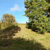
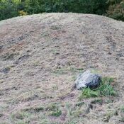
* The mound is grass-grown.
* It is planted with young fruit trees, or characterized by deciduous thicket and deciduous trees as of 1983.
* A large tree grows on the side of the mound.
* A path has been formed leading up to the top. Visitors can climb the mound to achieve a good view of the other mounds in the area.
Gammel Hestehave is considered a »national attraction« and has been classified as an ancient monument of national importance since 2010. It is a protected site (Fredet), with protection status dating back to 1937 or later. The Fredningsnr. (protection number) is 411710.
The site has undergone several official surveys and monitoring visits:
* In 1947, activities included cultivation/agriculture and forestry, legal registration (Tinglysning), and a museum survey by the Nationalmuseet.
* A new survey of the protected location took place in 1983.
* Periodic supervision of the protected location was carried out by Museum Odense in 2009 and 2019.
* In 2010, new public communication/signage was implemented at the site as part of the project “Danmarks Oldtid i Landskabet” (Denmark’s Antiquity in the Landscape).
Administrative features available at the location include a parking lot, a sign for the ancient monument, and a sign for the public road. The museum responsible for the site is Arkæologi Sydfyn.
--------------------------------------------------------------------------------------------------------------------------------------------------------------------------------------------------------------------------------------------
The landscape at Gammel Hestehave (Gl. Hestehave) has historically held significance, with the first settlements established along the coastline 5,000 years ago. The importance of the area is most clearly evidenced during the late Stone Age and early Bronze Age (1900–1100 BC), when settlements relocated slightly further inland. The Gl. Hestehave settlement functioned as a crucial community (bygd) and an important meeting place situated by the Svendborg Sound, offering views of the islands Thurø and Tåsinge.
During the early Bronze Age (1700–1100 BC), a monumental burial field was constructed, containing 23 burial mounds (gravhøje) of varying sizes. The mounds served as the setting for the village community. At that time, the area was open countryside, allowing the mounds to be seen widely from places like the islands Thurø, Tåsinge, and beyond.
Building the mounds was a labor-intensive project that extended over a long period, requiring the entire community to share the undertaking of construction and burials. The mounds were likely built on pasture, using carefully cut grass turf. The largest mounds required tens of thousands of turf squares, which resulted in the surrounding land becoming infertile for an extended period.
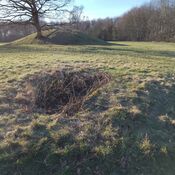
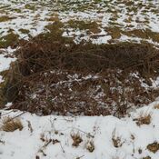
The mounds vary greatly in size. The largest are approximately 4 meters high with diameters spanning between 25 and 30 meters, while the smallest range from 0.5 to 1.5 meters high and measure 12 to 20 meters in diameter. These large burial mounds were built over one, two, or more graves, though none have been professionally examined. The area also features a small stone cist and a cup mark stone (“Æbleskivestenen”) marked with carved holy signs.
The construction of thousands of enormous burial mounds across Denmark was a clear expression of the superior skills of the new Bronze Age society. This period, which began 4,000 years ago, witnessed the emergence of ranked societies in Southern Scandinavia and Central Europe, where power and status were demonstrated through the use of gold and bronze. Chosen men and women were buried with fine weaponry and jewelry as grave goods, and sacrifices were made to powers responsible for fertility. Due to specific construction techniques that preserved the deceased’s chest, Denmark possesses a unique collection of 3,800-year-old costumes, including tunics and cloaks for men and various dresses and blouses for women.
The settlement at Gl. Hestehave participated in European trade, with residents sailing out to engage with continental contacts. Exotic acquisitions, such as harness decorations, may have been displayed during special events and processions. Furthermore, the area functioned as a casting site, where remains of several casting molds and a large crucible have been found. The bronze casting technology was advanced, involving stamping metal pieces in a wax model, covering it with a clay mold, and then melting the wax out to create an imprint for the liquid bronze.
Regarding settlement structure, new building practices arose, with people predominantly living on scattered, individual farmsteads. Some longhouses were exceptionally large, reaching up to 500 square meters, potentially accommodating the leading families of the community.
Today, the area is used for recreational activities such as hiking, dog walking, and mountain bike trails in the forest. It is also equipped with benches and explanatory signs for visitors.
kulturarv.dk/fundogfortidsminder/Lokalitet/9109/