
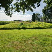
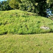
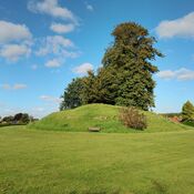
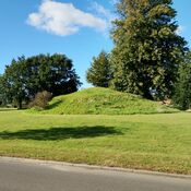
The Kroghenlund site is a Neolithic burial mound, specifically a dolmen (or round barrow), located in the Svendborg municipality. It dates back to the Stone Age, between 3950 and 2800 BC. The site has public access and is managed by Arkæologi Sydfyn. It was officially protected ("fredet") before 1937.
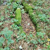
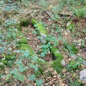
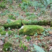
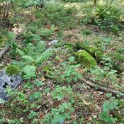
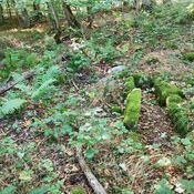
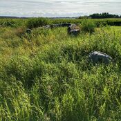
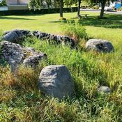
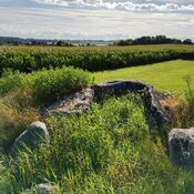
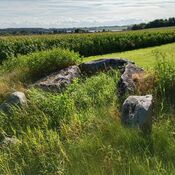
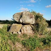
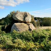
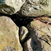
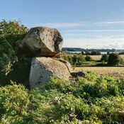
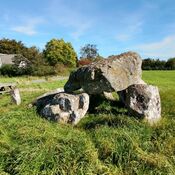
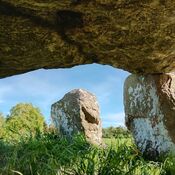
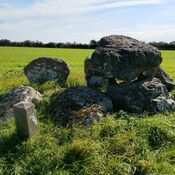
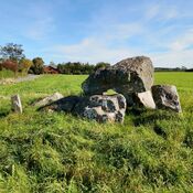
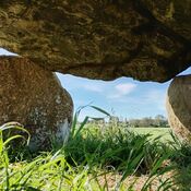
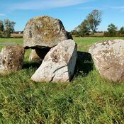
The dolmen consists of a large capstone resting on smaller support stones. The chamber underneath is quite small because the support stones do not lift the capstone very high. There is also a single, large, solitary stone standing a few meters away from the main structure.
Historical records provide slightly varying dimensions. A 1915 text describes the mound as 1 meter high and 14 meters in diameter, with a four-sided chamber measuring 1.40 meters long and 1.35 meters wide. A 1918 survey recorded the mound as about 1.5 meters high with a diameter of about 13 meters. A 1983 inspection noted the mound's measurements as 2.1 x 12 x 11 meters.
The large capstone has been damaged. It has been cleaved on two sides and has a series of drilled holes, suggesting an abandoned attempt to split the stone. A large, cleaved piece of the stone lies within the chamber. The chamber is partially filled with earth, and its south side is missing.
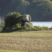
A tree has grown up against the large capstone, shaping itself around the stone to the point where it appears almost fused with it. In 1983, the site had both deciduous trees and coniferous thickets.
The site has a documented history of inspections and events dating back to the early 20th century:
1915: The site was officially registered (Tinglysning).
1918: A museum survey was conducted, and damage/vandalism was recorded by the National Museum of Denmark.
1947 & 1983: Further museum inspections took place. The 1983 inspection noted the illegal planting of spruce trees on the mound, and the landowner was contacted and promised to remove them.
2015: The most recent periodic inspection was carried out by Museum Odense.
A personal account from a visit on the autumn equinox, September 22, 2025, describes the weather as sunny with a light wind (5 m/s) and a temperature of 14°C. The visitor reflected on the possibility that solstices and equinoxes were celebrated with religious ceremonies at such sites thousands of years ago.
www.youtube.com/watch?v=xgh9kaV-NAo
www.kulturarv.dk/fundogfortidsminder/Lokalitet/9065/


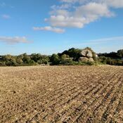
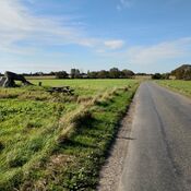
Surroundings:

Location:
- Denmark, Rødme
- geo:55.123241,10.466575
- Location ± 0-5 m.
Period or year:
- -3000 / unknown
Class:
- Grave or burial field
- visible
Identifiers:
- vici:place=101954
Annotations
Nearby
Folehave Skov Stenkiste (5 km)
Folehave Skov Cist
Vester Aaby jættestue (7 km)
Vester Aaby jættestue
Rundhøj Vester Aaby (7 km)
Rundhøj Vester Aaby