
http://canmore.rcahms.gov.uk/en/site/25402/details/black+hill/

Location:
- United Kingdom of Great Britain and Northern Ireland, Kinclaven
- geo:56.533875,-3.361125
- Location ± 5-25 m.
Period or year:
- 82 / 87
Class:
- Watchtower
- invisible
Identifiers:
- vici:place=12471
Annotations
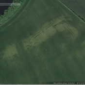
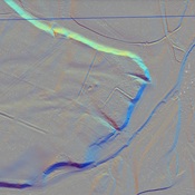
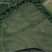
Die Ausgrabung von 1939 enthüllte die Pfostenlöcher eines Holzturms von etwa 4 Quadratmetern im Durchmesser; Es gab deutliche Spuren eines subrechteckigen Erdwalles am oberen Rand des Hügels, der den Wachturm umgab. Von ihm ist jetzt nichts mehr sichtbar, da der Hügel stark mit Vegetation überwuchert ist. Er bestand aus Rasensoden, war 3,7 m breit und blieb bis zu einer Höhe von 1,1 m über dem antiken Bodenniveau erhalten. Vom V-förmigen Wehrgraben ist jetzt kaum mehr als eine Bodenerhebung um den Hügel zu sehen, er war 5,2 m breit und von einem schmalen Erddamm im NNW unterbrochen.
https://de.wikipedia.org/wiki/Kleinkastelle_und_Wacht%C3%BCrme_der_Gask_Ridge
Nearby
Cargill Fort
Cargill Fort
Cargill Fortlet (1 km)
Cargill Fortlet
Castle Hill (1 km)
Iron Age ettlement